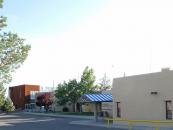
Gallery
Map and nearest places
| Longitude | Latitude |
|---|---|
| 36.710833 | -107.982778 |
| 36°42'0"N | 107°58'0"W |
| Nearest places | ||
|---|---|---|
| Aztec | 12.9km | |
| Aztec Municipal Airport | 14.4km | |
 | Farmington | 18.0km |
| Four Corners Regional Airport | 22.3km | |
| Navajo Dam | 31.3km | |
| Navajo Lake Airport | 31.4km | |
| Durango-La Plata County Airport | 53.0km | |
| Durango | 63.4km | |
| Cortez Municipal Airport | 87.2km | |
| Cortez | 88.5km | |
| Stevens Field Airport | 104.2km | |
| Pagosa Spring | 105.3km | |
| John Paul II International Airport | 9,091.1km | |
| Sir GaŽtan Duval Airport | 17,950.5km | |
Wineries
Weblinks
Comments
You need to log in to add comment


