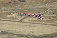
Gallery
Map and nearest places
| Longitude | Latitude |
|---|---|
| 70.7433333333333 | -22.660555555555604 |
| 70°44'0"N | 22°39'0"W |
| Nearest places | ||
|---|---|---|
 | Ittoqqortoormiit | 38.5km |
| Grimsey Airport | 500.7km | |
 | Grimsey | 504.4km |
 | Bolungarvik | 511.3km |
 | Isafjordur | 519.3km |
 | Vaeroy | 520.3km |
| Isafjordur Airport | 521.3km | |
 | Siglufjordur | 529.7km |
| Siglufjordur Airport | 534.7km | |
| Gjogur Airport | 536.3km | |
| Pingeyri Airport | 543.1km | |
| Kopasker Airport | 553.0km | |
| John Paul II International Airport | 3,150.7km | |
| Stewart Island Airport | 17,302.0km | |
General informations
| World Pax Ranking 2012 | #2306 |
| Year | Pax |
|---|---|
| 2012 | 3547 |
Weblinks
Comments
You need to log in to add comment


