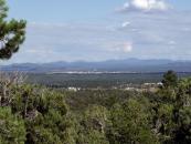
Gallery
Map and nearest places
| Longitude | Latitude |
|---|---|
| 34.2436111111111 | -110.048055555556 |
| 34°14'0"N | 110°2'0"W |
| Nearest places | ||
|---|---|---|
| Show Low Regional Airport | 4.6km | |
| Pinetop-Lakeside | 13.7km | |
| Taylor Airport | 24.1km | |
| Taylor | 25.2km | |
| Snowflake | 29.9km | |
| Heber-Overgaard | 51.0km | |
| Greer | 60.2km | |
| Saint Johns | 68.4km | |
| St. Johns Industrial Air Park | 68.6km | |
| Springerville Municipal Airport | 69.0km | |
| Winslow-Lindbergh Regional Airport | 106.3km | |
| Payson Airport | 118.7km | |
| John Paul II International Airport | 9,422.2km | |
| Sir GaŽtan Duval Airport | 18,278.2km | |
Accomodation
Airports
Weblinks
Comments
You need to log in to add comment


