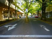
Map and nearest places
| Longitude | Latitude |
|---|---|
| 44.0519444444444 | -123.086666666667 |
| 44°3'0"N | 123°5'0"W |
| Nearest places | ||
|---|---|---|
| Eugene Airport | 13.2km | |
| Junction City | 21.0km | |
| Monroe | 33.9km | |
| Sweet Home | 48.7km | |
| Corvallis Municipal Airport | 52.1km | |
| Lebanon State Airport | 54.6km | |
| Lebanon | 55.4km | |
| Philomath | 58.6km | |
| Corvallis | 59.6km | |
| Albany Municipal Airport | 65.2km | |
| Florence Municipal Airport | 82.3km | |
| Roseburg Regional Airport | 93.0km | |
| John Paul II International Airport | 8,948.2km | |
| Tolagnaro Airport | 17,716.7km | |
Restaurants
Golfs club
Wineries
Spirits Distillery
Airports
Weblinks
Comments
You need to log in to add comment


_1088446926_130.jpg)

_1_1129452976_130.jpg)
_4_1195461137_130.jpg)

