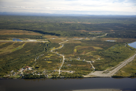
Gallery
Map and nearest places
| Longitude | Latitude |
|---|---|
| 66.5633333333333 | -152.647222222222 |
| 66°33'0"N | 152°38'0"W |
| Nearest places | ||
|---|---|---|
| Allakaket Airport | 1.7km | |
| Bettles Airport | 62.7km | |
| Bettles | 62.9km | |
| Hughes | 92.2km | |
| Hughes Airport | 92.9km | |
| Ralph M. Calhoun Memorial Airport | 156.4km | |
| Tanana | 157.0km | |
| Anaktuvuk Pass Airport | 178.8km | |
| Anaktuvuk Pass | 180.0km | |
| Huslia Airport | 192.4km | |
| Huslia | 193.6km | |
| Ambler | 235.3km | |
| John Paul II International Airport | 7,029.3km | |
| Port Elizabeth Airport | 16,390.8km | |
Airports
Weblinks
Comments
You need to log in to add comment


