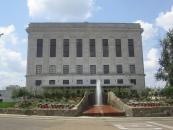
Gallery
Map and nearest places
| Longitude | Latitude |
|---|---|
| 33.433055555555605 | -94.02055555555559 |
| 33°25'0"N | 94°1'0"W |
| Nearest places | ||
|---|---|---|
| Texarkana Regional Airport | 3.6km | |
| Springhill | 70.8km | |
| De Queen | 73.7km | |
| Mangolia | 75.2km | |
| Springhill Airport | 75.7km | |
| Magnolia Municipal Airport | 78.1km | |
| Shreveport Downtown Airport | 102.5km | |
| Marshall | 104.0km | |
| Harrison County Airport | 104.9km | |
| Shreveport | 105.2km | |
| Camden | 111.0km | |
| Shreveport Regional Airport | 111.2km | |
| John Paul II International Airport | 8,683.2km | |
| Cocos Islands Airport | 17,408.2km | |
Restaurants
Golfs club
Airports
Weblinks
Comments
You need to log in to add comment


