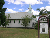
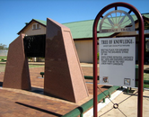
Gallery
Map and nearest places
| Longitude | Latitude |
|---|---|
| -23.566666666666702 | 145.283333333333 |
| 23°34'0"S | 145°16'0"E |
| Nearest places | ||
|---|---|---|
| Barcaldine Airport | 2.4km | |
| Blackall | 96.3km | |
| Blackall Airport | 96.9km | |
| Longreach Airport | 103.3km | |
| Longreach | 106.2km | |
| Winton Airport | 261.8km | |
| Winton | 264.4km | |
| Emerald | 292.3km | |
| Emerald Airport | 295.1km | |
| Hughenden | 322.6km | |
| Hughenden Airport | 324.8km | |
| Charleville | 329.8km | |
| John Paul II International Airport | 14,500.5km | |
| Sao Pedro Airport | 18,760.0km | |
Accomodation
Restaurants
Airports
Weblinks
Comments
You need to log in to add comment


