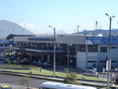
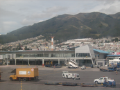
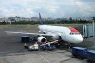
Map and nearest places
| Longitude | Latitude |
|---|---|
| -0.14111111111111102 | -78.4886111111111 |
| 0°8'0"S | 78°29'0"W |
| Nearest places | ||
|---|---|---|
| Quito | 16.0km | |
| Atahualpa Airport | 66.2km | |
 | Ibarra | 68.8km |
| Santo Domingo Los Colorados | 74.5km | |
| Santo Domingo Los Colorados Airport | 81.6km | |
| Cotopaxi International Airport | 86.3km | |
 | Latacunga | 89.1km |
 | Puyo | 116.3km |
| Chachoan Airport | 119.5km | |
 | Ambato | 123.2km |
| El Rosal - Teniente Mantilla Airport | 136.8km | |
| Rio Amazonas Airport | 158.9km | |
| John Paul II International Airport | 10,608.8km | |
| Sultan Syarif Qasim II International Airport | 19,978.8km | |
General informations
| Airport type | Regional airport |
| ICAO | SEQU |
| IATA | UIO |
| Elevation | 9,228 ft / 2,813 m MSL |
| World Pax Ranking 2023 | #309(+17) |
| World Pax Ranking 2022 | #326(+223) |
| World Pax Ranking 2021 | #549(+85) |
| World Pax Ranking 2020 | #634(-289) |
| World Pax Ranking 2019 | #345(-11) |
| World Pax Ranking 2018 | #334(-9) |
| World Pax Ranking 2017 | #325(-11) |
| World Pax Ranking 2016 | #314(-29) |
| World Pax Ranking 2015 | #285(-13) |
| World Pax Ranking 2014 | #272(-13) |
| World Pax Ranking 2013 | #259(-1) |
| World Pax Ranking 2012 | #258(+2) |
| World Pax Ranking 2011 | #260(-5) |
| World Pax Ranking 2010 | #255(+1) |
| Year | Pax |
|---|---|
| 2024 | 5357564 |
| 2023 | 5460212 |
| 2022 | 4300000 |
| 2021 | 1198780 |
| 2020 | 683929 |
| 2019 | 5037650 |
| 2018 | 5228072 |
| 2017 | 4875166 |
| 2016 | 4852530 |
| 2015 | 5376544 |
| 2014 | 5541559 |
| 2013 | 5500000 |
| 2012 | 5404958 |
| 2011 | 5120000 |
| 2010 | 5000000 |
| 2009 | 4559493 |
| 2008 | 4500000 |
| 2007 | 4427591 |
| 2006 | 4026600 |
| 2005 | 3475204 |
| 2004 | 3026498 |
| 2003 | 3431495 |
| 2002 | 2601424 |
| 2001 | 3139038 |
| 2000 | 2043811 |
| 1999 | 1868349 |
| 1998 | 2372550 |
| 1997 | 2318676 |
| 1996 | 2270541 |
| 1995 | 2145114 |
Weblinks
Comments
You need to log in to add comment


