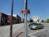
Map and nearest places
| Longitude | Latitude |
|---|---|
| 31.2272222222222 | -85.4072222222222 |
| 31°13'0"N | 85°24'0"W |
| Nearest places | ||
|---|---|---|
| Dothan Regional Airport | 11.2km | |
| Headland | 15.4km | |
| Headland Municipal Airport | 17.7km | |
| Enterprise | 43.0km | |
| Tri-County Airport | 46.3km | |
| Enterprise Municipal Airport | 47.5km | |
| Marianna Municipal Airport | 48.3km | |
| Marianna | 52.7km | |
| Bonifay | 55.1km | |
| Arlington | 69.0km | |
| Eufaula | 77.4km | |
| Weedon Field Airport | 84.7km | |
| John Paul II International Airport | 8,372.8km | |
| Kalbarri Airport | 18,073.6km | |
Accomodation
Restaurants
Golfs club
Breweries
Airports
Weblinks
Comments
You need to log in to add comment


