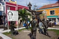
Gallery
Map and nearest places
| Longitude | Latitude |
|---|---|
| 18.4666666666667 | -77.9166666666667 |
| 18°28'0"N | 77°55'0"W |
| Nearest places | ||
|---|---|---|
| Sangster International Airport | 4.1km | |
| Negril Airport | 42.6km | |
| Negril | 47.8km | |
| Ocho Rios | 84.6km | |
| Boscobel Airport | 100.2km | |
| Tinson Pen Aerodrome | 127.1km | |
| Kingston | 129.6km | |
| Norman Manley International Airport | 133.1km | |
| Ken Jones Airport | 148.9km | |
| Port Antonio | 166.5km | |
| Cayman Brac | 242.0km | |
| Little Cayman | 261.8km | |
| John Paul II International Airport | 8,975.1km | |
| Cocos Islands Airport | 19,118.5km | |
Spirits Distillery
Airports
Weblinks
Comments
You need to log in to add comment


