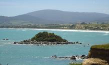
Gallery
Map and nearest places
| Longitude | Latitude |
|---|---|
| -46.2833333333333 | 167.73333333333298 |
| 46°16'0"S | 167°43'0"E |
| Nearest places | ||
|---|---|---|
| Tuatapere | 17.1km | |
| Riverton | 23.0km | |
| Invercargill Airport | 46.7km | |
| Invercargill | 49.3km | |
| Bluff | 57.9km | |
| Stewart Island Airport | 74.1km | |
| Stewart Island | 75.1km | |
| Manapouri | 80.4km | |
| Manapouri Airport | 83.7km | |
| Queenstown International Airport | 160.7km | |
| Milford Sound Airport | 179.6km | |
| Dunedin International Airport | 194.1km | |
| John Paul II International Airport | 17,620.7km | |
| La Coruna Airport | 19,563.4km | |
Weblinks
Comments
You need to log in to add comment


