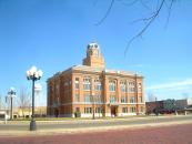
Gallery
Map and nearest places
| Longitude | Latitude |
|---|---|
| 34.979444 | -101.925833 |
| 34°58'0"N | 101°55'0"W |
| Nearest places | ||
|---|---|---|
| Amarillo | 25.5km | |
| Rick Husband Amarillo International Airport | 33.3km | |
| Hereford Municipal Airport | 38.9km | |
| Hereford | 46.5km | |
| Borger | 89.6km | |
| Hutchinson County Airport | 93.6km | |
| Moore County Airport | 98.0km | |
| Dumas | 98.3km | |
| Pampa | 107.4km | |
| Clovis Municipal Airport | 122.1km | |
| Dalhart Municipal Airport | 128.9km | |
| Dalhart | 131.7km | |
| John Paul II International Airport | 8,962.6km | |
| Sir GaŽtan Duval Airport | 17,790.1km | |
Accomodation
Restaurants
Museums
Wineries
Weblinks
Comments
You need to log in to add comment


