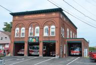
Gallery
Map and nearest places
| Longitude | Latitude |
|---|---|
| 44.76481 | -69.718389 |
| 44°45'0"N | 69°43'0"W |
| Nearest places | ||
|---|---|---|
| Norridgewock | 7.9km | |
| Central Maine Airport of Norridgewock | 12.9km | |
| Madison | 13.3km | |
 | Waterville | 24.4km |
| Waterville Robert LaFleur Airport | 26.0km | |
| Vassalboro | 34.1km | |
| Farmington | 35.5km | |
| Kingfield | 40.6km | |
| Dexter Regional Airport | 46.3km | |
| Augusta State Airport | 49.8km | |
| Sugarloaf Regional Airport | 53.0km | |
| Belfast Municipal Airport | 68.5km | |
| John Paul II International Airport | 6,342.9km | |
| Albany Airport | 18,749.3km | |
Accomodation
Museums
Breweries
Weblinks
Comments
You need to log in to add comment


