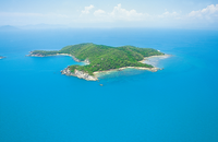
Gallery
Map and nearest places
| Longitude | Latitude |
|---|---|
| -18.003889 | 146.148889 |
| 18°0'0"S | 146°8'0"E |
| Nearest places | ||
|---|---|---|
| Dunk Island | 6.4km | |
| Dunk Island Airport | 7.2km | |
| Mission Beach | 15.6km | |
| Palm Island | 93.2km | |
| Palm Island Airport | 95.2km | |
| Walkamin | 123.8km | |
| Cairns | 126.3km | |
| Cairns Airport | 132.4km | |
| Green Island | 139.7km | |
| Townsville Airport | 153.3km | |
| Bloomfield Airport | 252.4km | |
| Cooktown Airport | 302.5km | |
| John Paul II International Airport | 14,098.6km | |
| Sao Pedro Airport | 19,072.9km | |
Weblinks
Comments
You need to log in to add comment


