


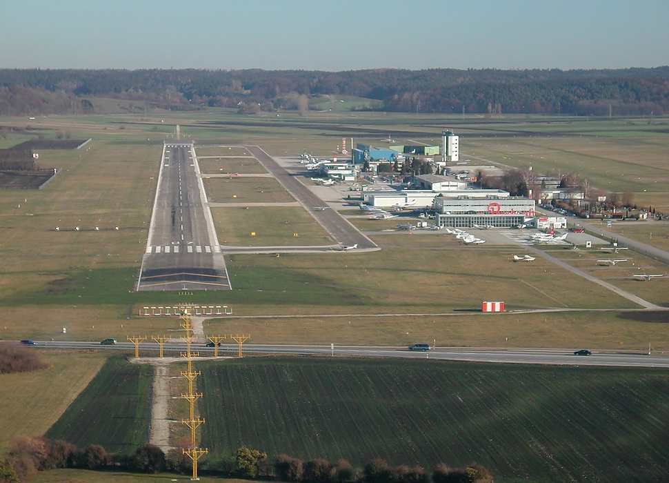
Gallery


Map and nearest places
| Longitude | Latitude |
|---|---|
| 48.4261111111111 | 10.933055555555601 |
| 48°25'0"N | 10°55'0"E |
| Nearest places | ||
|---|---|---|
 | Augsburg | 7.5km |
 | Aichach | 15.0km |
 | Rain | 28.6km |
 | Donauw�rth | 32.0km |
 | F�rstenfeldbruck | 36.5km |
 | Dillingen an der Donau | 37.8km |
| Ingolstadt Airport | 54.7km | |
| Franz Josef Straus International Airport | 63.6km | |
| Memmingen Airport | 70.7km | |
| Laupheim Airport | 79.0km | |
| Landshut Airport | 81.8km | |
| Reutte Airport | 107.5km | |
| John Paul II International Airport | 667.7km | |
| Tuuta Airport | 19,249.0km | |
General informations
| Airport type | Local airport |
| ICAO | EDMA |
| IATA | AGB |
| Elevation | 1,516 ft / 462 m MSL |
| Year | Pax |
|---|---|
| 2006 | 143895 |
| 2005 | 45204 |
| 2004 | 79300 |
| 2003 | 95144 |
| 2002 | 148842 |
| 2001 | 214028 |
| 2000 | 247347 |
| 1999 | 240369 |
| 1998 | 219044 |
| 1997 | 180846 |
| 1996 | 135917 |
| 1995 | 126536 |
Weblinks
Comments
You need to log in to add comment